Nonetheless, dune erosion volumes would
not be predicted accurately when the pattern
of sediment deposition and alongshore
transport is not accurate. Moreover, for safety
assessments, accurate prediction of erosion
volumes is of primary interest.
Based on these validation results, it is
concluded that 2D XBeach modelling is
required to accurately capture dune erosion at
strongly curved coastlines. Furthermore, the
validation shows that the 1D BOI settings can
accurately model dune erosion at Maasvlakte 2
when applied in a 2D XBeach model.
Discussion
The validation of a two-dimensional XBeach
model (BOI2023 version) with 1D BOI model
settings to model a curved coastline is a
successful first step. However, there are still
sufficient challenges before XBeach 2D can
be considered a valid model for generic
curved coastlines. The profile shape of the
Maasvlakte is rather simple, with a steep
foreshore and a single dune row. This profile
resembles those at the Dutch coast and
is close to many cases used to calibrate
the model settings. The effects of the
tidal current are limited to the deeper
foreshore and there are no shoals that
induce additional gradients in alongshore
transport, as would be the case at the
curved coastlines at the heads of the
Wadden Islands, which are sheltered
by an ebb delta.
Regarding future safety assessment with
2D XBeach models, our results imply that it
will be important to model storms with a
non-stationary wave direction and multiple
storms with varying peak direction, since a
stationary wave angle would significantly
underestimate the dune erosion at the point
of perpendicular wave incidence.
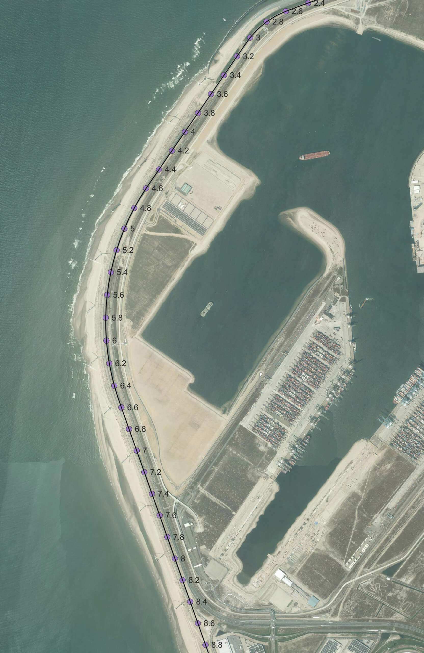
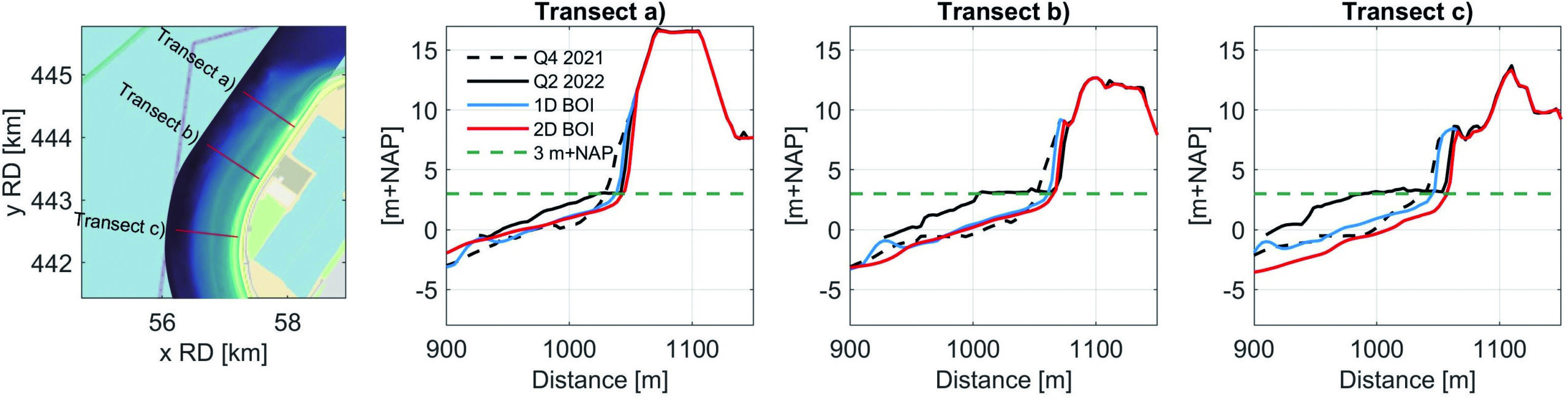
Conclusion
The dune erosion measurements following
the 2022 winter storms at Maasvlakte 2
have been used to validate a 2D XBeach
model. This validation event, which is the
first proper validation possibility for a dune
erosion event at the curved Maasvlakte 2,
is successfully utilised to gain insight into
the performance of the 1D BOI model
settings and the necessity of a 2D modelling
approach at a curved coastline.
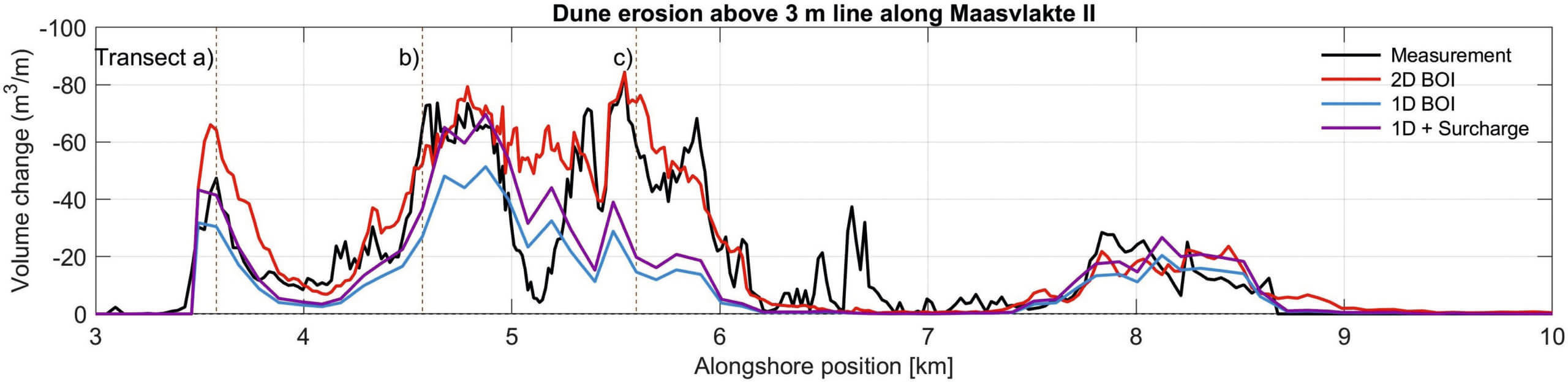
The XBeach simulations, which have
been carried out following both a 1D and 2D
modelling approach, revealed that the 2D
model with 1D BOI model settings was most
capable of reproducing the dune erosion
volumes accurately, while a significant
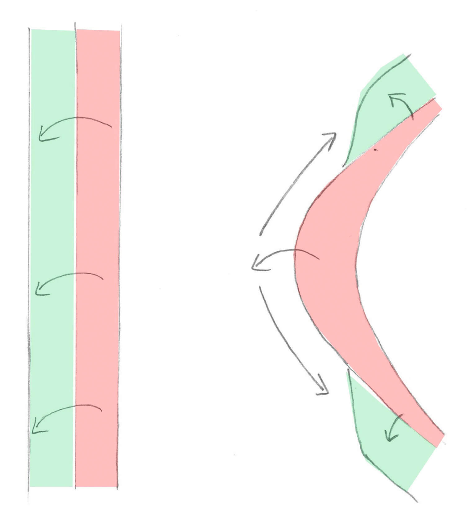
underestimation of dune erosion is observable
in the 1D model. This underestimation in the
1D model occurred at the strongly curved
coastal section of Maasvlakte 2 and could
not be compensated for by the prescribed
surcharge for 1D modelling approaches at
curved coastlines. The underestimation in the
1D modelling approach is likely related to the
absence or underestimation of alongshore
sediment distribution processes at strongly
curved coastlines. This process prevents
localised build-up of eroded sediment on the
foreshore as it is redistributed alongshore,
leaving the dune vulnerable to undiminished
wave attacks throughout the entire storm
duration. Therefore, a 2D modelling
approach appears to be required for strong
curved coasts such as Maasvlakte 2
and is highly advised in similar situations
(in the Netherlands).
Results from this study highlight the
importance of applying a 2D process-based
model such as XBeach on strongly curved
coastlines to assess the safety of the dunes
under storm conditions. Moreover, the
study results suggest that it is important
to include non-stationary wave direction
when modelling the normative storm
conditions to prevent underestimation
of the dune erosion. This prompts us to
reconsider the schematisation of the
normative storm for strongly curved coastal
systems, encouraging further research
and discussion.